


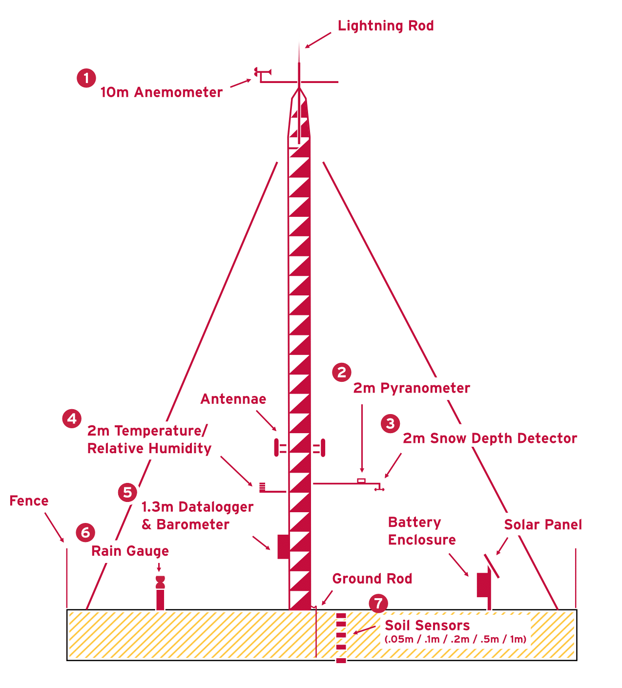
1
10m - Anemometer
Measures horizontal wind speed & direction
R.M. Young Model 05108
Range:
0 to 100 m/s (224 mph)
360° mechanical, 355° electrical (5° open)
A mesonet tower can host multiple sensors to collect meteorological data. Adjacent sensors collect rainfall, soil moisture, and soil temperature data. All collected data is sent to UMD data servers in real-time via cellular transmission. The entire mesonet site is solar powered, with battery backup.
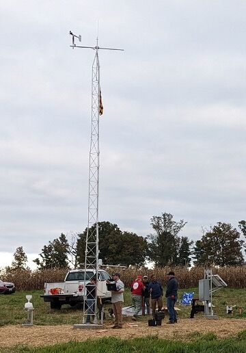
Above: The first Maryland Mesonet tower, located in Howard County, is installed.
Measures horizontal wind speed & direction
R.M. Young Model 05108
Range:
0 to 100 m/s (224 mph)
360° mechanical, 355° electrical (5° open)
Measures global (direct + diffuse) solar radiation
Apogee Model CS320
Range:
0 to 2000 W/m2
Measures snow depth
Campbell Model SnowVUE10
Range:
0.40 to 10m (1.3 to 32.8 ft)
Measures air temperature and relative humidity
Campbell Model HygroVUE10
Range:
-40° to 70° C (-40° to 158° F)
0 to 100% humidity
A low-power device that reads the tower's sensors, drives communication, controls external devices, then analyzes and maintains the data in onboard, nonvolatile storage.
Campbell Model CR1000X
Measures atmospheric pressure
Campbell Model BaroVUE10
Range:
500 to 1100 hPa
Measures rainfall intensity and derives amount of rainfall
Campbell Model RainVUE20
Range:
1500 mm/h (60 in/h)
Measures permittivity, electrical conductivity, temperature, and water content of the soil
Campbell Model CS655
Range:
Permittivity: 1 to 81
Conductivity: 0 to 8 dS/m
Temperature: -50° to 70° C (-58° to 128° F)
Water Content: 0 to 100%